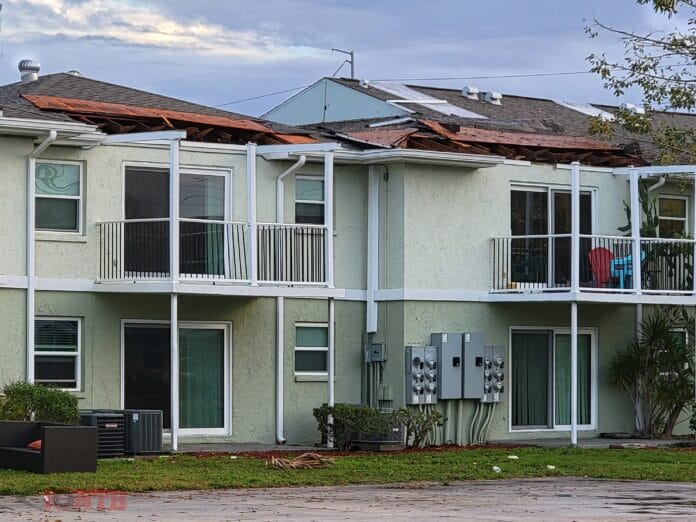
The National Weather Service (NWS) in Tampa Bay visited the area that experienced damage overnight from a line of storm at approximately 1 a.m. on Sunday, February 14, 2021.
The thunderstorms rolled in from the eastern Gulf of Mexico. One of these storms took on brief supercell characteristics with strong rotation evident on radar as it came into Redington Beach.
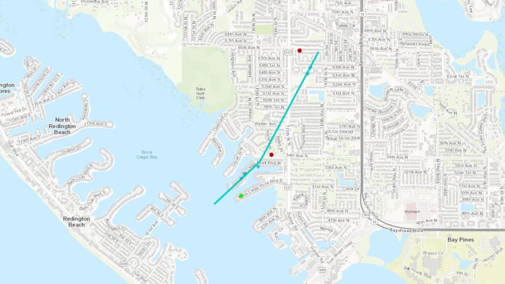
A NWS meteorologist was unable to find any damage on the barrier island, so it was determined a waterspout formed over Boca Ciega Bay, moving northeast.
The waterspout then came onshore and caused a vary narrow swath of EF-0 damage along Boca Ciega Point Blvd N.
The tornado then tracked north-northeast and caused roof damage to the Ridgeview Apartment complex. The peak intensity of 75 mph was determined by the roof decking damage to the apartment. The tornado then quickly dissipated.
A slight risk for severe weather remains in the West Central Florida area on Sunday. That right is downgraded to a marginal risk for Monday.
Details on the EF-0 Tornado
RATING: EF0
ESTIMATED PEAK WIND: 75 MPH
PATH LENGTH /STATUTE/: 1.306 MILES
PATH WIDTH /MAXIMUM/: 30 YARDS
FATALITIES: 0
INJURIES: 0
START DATE: 02/14/2021
START TIME: 01:07 AM EST
START LOCATION: 1 NE REDINGTON BEACH / / FL
START LAT/LON: 27.8165 / -82.8038
END DATE: 02/14/2021
END TIME: 01:14 AM EST
END LOCATION: 1 SSW SEMINOLE / PINELLAS COUNTY / FL
END LAT/LON: 27.832 / -82.792
EF SCALE: THE ENHANCED FUJITA SCALE CLASSIFIES TORNADOES INTO THE
FOLLOWING CATEGORIES:
EF0…WEAK……65 TO 85 MPH
EF1…WEAK……86 TO 110 MPH
EF2…STRONG….111 TO 135 MPH
EF3…STRONG….136 TO 165 MPH
EF4…VIOLENT…166 TO 200 MPH
EF5…VIOLENT…>200 MPH
-
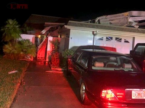
Damage from EF-0 tornado -
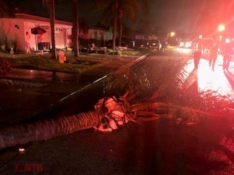
Damage from EF-0 tornado -
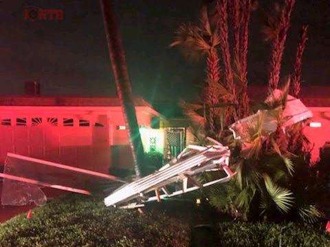
Damage from EF-0 tornado
