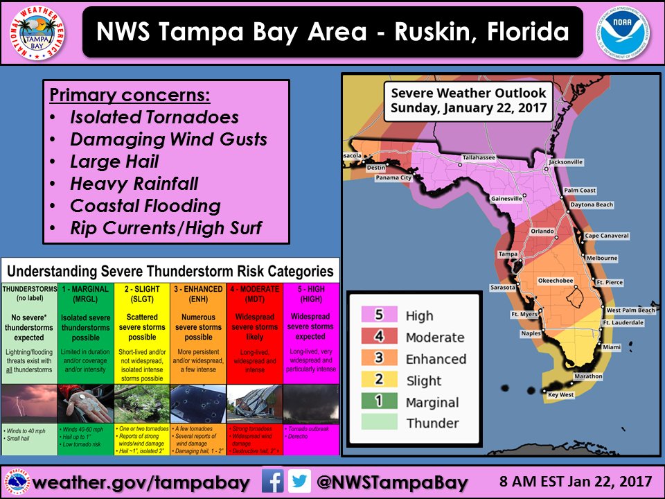
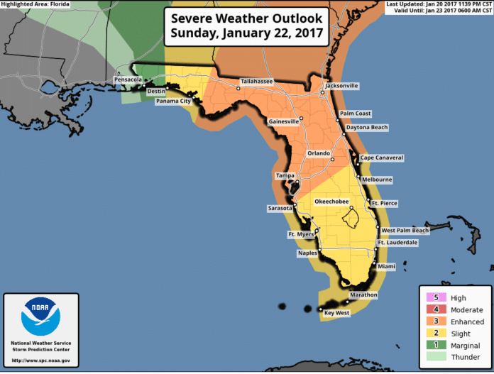
A strong cold front is currently moving south into Florida and will impact our regional area on Sunday.
The area ahead of this front will likely bring strong to severe storms into our region.
An Enhanced risk of severe storms will be possible across west central Florida during Sunday and Sunday evening, with a slight risk of severe storms across southwest Florida. Pinellas County will feel impacts beginning Sunday afternoon through Sunday evening.
At the present time, damaging thunderstorms winds, large hail, and isolated tornadoes will be the main hazards from the storms as they move across the region.

The Weather-Ready Nation Ambassador initiative is an effort to formally recognize NOAA partners who are improving the nation’s readiness against extreme weather, water, and climate events
In the wake of the cold front, a strong and gusty westerly wind flow will produce very hazardous boating conditions on the Gulf waters with frequent wind gusts to gale force likely, along with seas building into the 10 to 15 foot range. The strong onshore flow may also produce some minor coastal flooding at times of high tide during Sunday night into Monday along with high surf and a high risk of rip currents along area beaches.
All residents and visitors of west central and southwest Florida should continue to monitor the latest forecast tonight through Sunday.
Residents living along the coast should take steps to protect life and property should coastal flooding occur. Mariners are urged to postpone trips into the gulf later today through Monday due to the hazardous boating conditions expected.

